
Inspecting a bridge used to mean sending people into difficult-to-reach places. Surveying a large construction site could require hours of work on the ground. Today, drones are giving engineers, inspectors, construction teams, and planners an entirely different perspective—one that happens to come from the sky.
Drones in infrastructure and urban planning can help professionals capture aerial images, survey large areas, monitor construction progress, create maps, and inspect locations that may be difficult or time-consuming to reach.
As cameras, GPS, sensors, mapping software, and automated flight technology continue to improve, drones are becoming increasingly useful tools for understanding the places where we live, work, and travel.
Infrastructure includes the roads, bridges, buildings, utilities, transportation systems, and other structures that help communities function.
Maintaining all of it requires regular observation and inspection.
Drones can provide aerial views of infrastructure and allow professionals to examine areas from perspectives that aren’t easily available from the ground.
Depending on the equipment and application, drones may be used to capture photographs and video, collect mapping information, monitor changes, and help identify areas that deserve closer inspection.
Interested in today’s drone technology? Explore drones at Today’s Gadget Needs.
Bridges can contain areas that are difficult to see from normal ground-level positions.
Traditionally, reaching some of those areas may require specialized equipment or other access methods.
A camera-equipped drone can provide another way to visually examine certain parts of a structure from a distance.
High-resolution aerial photographs and video can help inspection teams document visible conditions and determine which locations may require additional examination.
Drones don’t replace qualified inspectors or engineering assessments. Instead, they can provide another useful source of visual information.
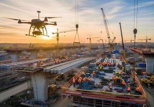
Construction sites can change dramatically from week to week.
Drone photography allows project teams to document that progress from a consistent aerial perspective.
Regular flights can create a visual record showing how a project develops over time.
Aerial imagery may also make it easier to see the overall layout of a construction site, rather than viewing individual sections only from ground level.
For project managers and other professionals, having both perspectives can provide a clearer picture of what’s happening across a large site.
Mapping is another important application of drone technology.
By capturing images across an area, specialized drone systems and software can help create detailed maps and models.
This information can assist professionals involved in construction, land management, engineering, and planning.
Instead of viewing an area from only one location, aerial mapping provides a broader perspective that can make patterns and relationships easier to understand.
The quality and usefulness of the information depend on the drone, sensors, software, flight conditions, and the requirements of the project.
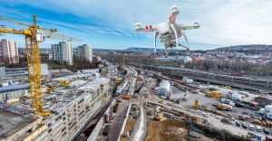
Cities are constantly changing.
New neighborhoods are built. Roads are expanded. Buildings are constructed. Parks are developed. Transportation patterns evolve.
Urban planners need information to understand these changes and make informed decisions.
Drone imagery can provide current aerial views of particular areas and help professionals visualize how land, buildings, roads, and other features relate to one another.
This can be especially useful when studying development areas or documenting changes over time.
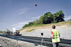
Road networks cover enormous distances, making them another potential application for drone technology.
Drones can capture aerial images of roads, intersections, construction areas, and surrounding infrastructure.
Depending on the application, this information may help teams document conditions, observe traffic-related patterns, monitor projects, or identify areas requiring closer examination.
Aerial imagery can also help provide context. Instead of looking at one small section of roadway, planners can see how multiple roads, buildings, and surrounding areas connect.
One of the biggest advantages of drones is their ability to reach places that may be inconvenient or difficult for people to access.
Towers, rooftops, elevated structures, large properties, and certain utility infrastructure can all present inspection challenges.
A drone can sometimes provide an initial visual perspective without requiring a person to immediately access every location physically.
This can help professionals determine where additional inspection may be necessary.
Safety procedures and applicable regulations remain essential, particularly when drones are operated near infrastructure, people, traffic, or restricted areas.
One aerial photograph can provide useful information.
A series of photographs taken over weeks, months, or years can provide something even more valuable—a record of change.
Repeated drone flights can document construction progress, development, land-use changes, storm damage, erosion, or other visible differences.
This ability to compare the same location over time is one reason drones can be useful across several industries.
The same concept is being used in agriculture and environmental research. Learn more in How Drones Are Transforming Agriculture and Conservation.
Infrastructure can be especially difficult to evaluate following severe weather or natural disasters.
Flooding, hurricanes, fires, and other events can damage roads, buildings, bridges, utilities, and surrounding areas.
Aerial imagery can provide emergency personnel and other professionals with another way to observe affected locations and understand visible conditions.
Drones can be particularly useful when an area is difficult or potentially dangerous to access immediately from the ground.
We’ve explored this subject further in Drones in Emergency Response and Public Safety.
The usefulness of a drone depends heavily on the technology it carries.
Modern drones may include high-resolution cameras, GPS positioning, stabilized flight, obstacle detection, automated flight functions, and return-to-home features.
More specialized professional drones can carry advanced sensors and imaging equipment designed for mapping, surveying, inspection, or other specific applications.
Consumer drones and professional infrastructure drones aren’t necessarily designed for the same jobs, but many share similar underlying technologies.
If you’d like to explore how modern drone technology has evolved, browse the latest drones at Today’s Gadget Needs.
Flying near buildings and infrastructure requires responsible decision-making.
Drone operators must consider airspace restrictions, people on the ground, surrounding structures, privacy, weather conditions, and applicable regulations.
Certain locations or operations may require additional authorization or have specific restrictions.
Technology such as GPS and obstacle detection can assist pilots, but automated features don’t replace responsible operation.
Before flying, operators should understand the rules that apply to their location and intended use.
Read our guide to Drone Safety, Privacy and Regulations for more information about responsible drone operation.
The role of drones in infrastructure could expand significantly as technology improves.
Better cameras, longer flight times, improved sensors, artificial intelligence, automated mapping, and advanced data analysis could allow drones to collect increasingly useful information.
AI-assisted systems may eventually help professionals analyze large amounts of aerial imagery and identify changes or unusual conditions that deserve human attention.
For urban planners, better aerial information could provide additional insight into how communities develop.
For infrastructure professionals, drones could make certain types of observation and documentation faster and more efficient.
Drones are changing more than photography and entertainment.
They’re becoming tools that can help professionals better understand buildings, roads, bridges, construction sites, land, and entire communities.
The real advantage is perspective.
Seeing infrastructure from above can reveal information that isn’t always obvious from ground level.
As drone technology continues to advance, that perspective could become an increasingly important part of how infrastructure is inspected, construction is documented, and communities are planned.
Want to explore drone technology for yourself? Check out the latest drones at Today’s Gadget Needs.
Check out this VIDEO to see how drone technology is shaping the future of infrastructure and urban planning. 🚁
